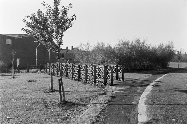
85-10n-46: Bridge across site of Cottingham Drain, Bridlington
Ave area, 1985 - Beverley.
Previous
Next to follow
Much of Hull is below
the level of the highest tides, and fairly large areas below sea level.
The whole of the Hull basin had been subject to extensive drainage schemes
since the early middle ages, with drainage ditches (known as drains or dykes)
discharging water from low-lying areas into the River Hull at low tides.
One of the older which came through to the Hull at High Flags was Setting
Dyke, and after the Cottingham Drain was dug following an Act of Parliament
around 1770 it joined to Setting Dyke between Ella Street and Victoria Avenue
near the southern end of Newland Avenue. The combined drain, now known as
the Cottingham Drain then continued east past Beverley Road before turneing
south parallet with Beverley Rd to go under Norfolk St and then turn east
again to meet the River Hull at High Flags.
There was still water in the Cottingham Drain when I first came to Hull
in the 1960s, but shortly after these drains were filled in, the water going
into the sewage system, Setting Dyke flowing into the sewer on National
Avenue and ottingham Drain into the sewer on Cottingham Road. The filled in drains
were grassed over, with much of their length becoming foot and cycle paths,
and you can still follow most of their course on satellite imagery.
This bridge was left in place, in parkland somewhere near Bridlington Avenue.
I looked for it briefly last year but couldn't find it, but it may well
still be there.