32p26: King George V Dock, 1982 - Docks
Previous Next
A view of Hull
Still Occupied
Images on this site are arranged into rough areas by location as in my book 'Still Occupied', available on Blurb. Eventually this site will contain all the images in that book and more.
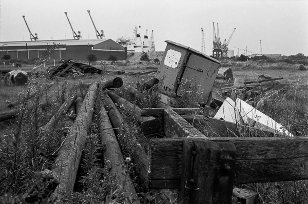
Taken somewhere on the walk from Alexandra Dock to King George V Dock, where you can see ships moored in the distance. It may be from where the path detoured slightly to cross the Holderness Drain which flows into the Humber here at Marfleet.
Drainage of the low-lying Hull valley has always been a problem, with flooding both from higher land to the north and tidal salt water from the Humber. Flood defences were certainly being built along the Hull and the Humber by the early 14th century, with simple sluices to allow water to flow into the rivers at lower tide levels. The sixteenth century saw the start of new drainage schemes, and a drain taking water from the north to the Humber at Marfleet was first proposed in 1671, but not dug. Just over a hundred years later a new plan was granted approval by Parliament, but with drainage into the Hull at Stoneferry, as Hull's shipping owners argued the flow of this water was needed to stop Humber mud silting up the Old Harbour on the River Hull. It was only in 1832 that permission was obtained for an outlet at Marfleet.
In 1885 the Alexandra Dock was opened immediately to the west of the Holderness drain, and water was then pumped from the drain to raise its level and stop the mud-heavy Humber water entering the dock around each high tide. The King George V dock immediately to the east, opened in 1913 and used more water was pumped from the drain for the same reason.
Peter Marshall
01784 456474